White River Narrows, in lower White River Valley, is a winding canyon formed during the Pleistocene (ca. 2.5 million to 11,700 years ago) and home to one of the largest concentrations of prehistoric rock art in eastern Nevada. It contains numerous rock art sites that collectively form a district covering some 4,000 acres that is listed on the National Register of Historic Places. White River Narrows Archaeological District was placed on the National Register of Historic Places in 1976.

Will you vote for me for Super Mom 2024??
The petroglyphs at White River Narrows provide glimpses into the cultural lives of Native American peoples who lived by harvesting wild plants and animals from some 4,000 years ago until the nineteenth century. Although the exact meanings of the Narrows’ rock art may be unknowable, they mark the Narrows as a place important to those who made and used these galleries of ancient art. These petroglyphs continue today to be important to Native American peoples living in the region. The rock art consists of two styles, one associated with hunter-gatherers (Basin and Range tradition) and one with Fremont groups.
The entrance (dirt road) to White River Narrows Archaeological District is 23.0 miles from the intersection of State Route 375, State Route 318 and U.S. Route 93 (the “Y”). Traveling north on State Route 318 towards Ely, it is 4.1 miles past the “White River Narrows Archaeological District” sign and is on the right (east) side of the road. Traveling south from Ely, it is approximately 90 miles and is on the left (east) side of the road. A yellow BLM marker is just to the right of the dirt road. Go through the gate and continue 2.15 miles to the register.
Pictures below are provided by contributors or supporters of this website. If you are interested in sharing your pictures of Nevada, please drop us a note.
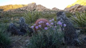
Courtesy T. Turner – Desert flowers in bloom