Trails within Caliente and surrounding state parks offer Lincoln County visitors an expanse of hiking options.
- Rattlesnake Loop Trail
- Overlook Trial
Experienced hikers may explore Kershaw-Ryan State Park’s back country above Rainbow Canyon via the 1.5-mile Overlook Trail. During the summer hikers should be alert for rattlesnakes, particularly along the trails and in the cool shady areas of the park. Also be alert for thunderstorms which may cause flash floods in the canyons. Plan hikes for the morning or evening hours. - Waterfall Trail
The Waterfall Trail visits natural and historic features including a hot spring, a waterfall, a small arch, and Civilian Conservation Corps structures. Beyond the trail’s end, the hike continues up Sheep Canyon before climbing up a small ridge.The trail is located at Beaver Dam State Park. This is Eastern Nevada’s most remote park and is a popular area for hikers and nature enthusiasts who enjoy its primitive and rustic character. Situated in rugged canyon country, this 2,393-acre park is located approximately thirty-four miles east of Caliente and is adjacent to the Utah border. Motorists can reach the park by driving six miles north of Caliente on US 93, then 28 miles east on a graded gravel road that leads to the park entrance.
Weather is highly seasonal with wide temperature swings. Summertime temperatures range from 95º F by midday and drop to 50º F at night. The park is open year-round, but due to harsh winter conditions, heavy snowfalls and below zero temperatures, the access is limited. During these winter months, only vehicles with four-wheel drive are recommended. Rainfall is variable with thunderstorms common in July and August. For more information about Beaver Dam State Park or to obtain current weather conditions at the park, contact the park office.
- Interpretive Trail
The Interpretive Trail is located at Beaver Dam State park and leads from Campground #2 to an overlook of Beaver Dam Wash.Beaver Dam State Park is Eastern Nevada’s most remote park and is a popular area for hikers and nature enthusiasts who enjoy its primitive and rustic character. Situated in rugged canyon country, this 2,393-acre park is located approximately thirty-four miles east of Caliente and is adjacent to the Utah border. Motorists can reach the park by driving six miles north of Caliente on US 93, then 28 miles east on a graded gravel road that leads to the park entrance.
Weather is highly seasonal with wide temperature swings. Summertime temperatures range from 95º F by midday and drop to 50º F at night. The park is open year-round, but due to harsh winter conditions, heavy snowfalls and below zero temperatures, the access is limited. During these winter months, only vehicles with four-wheel drive are recommended. Rainfall is variable with thunderstorms common in July and August. For more information about Beaver Dam State Park or to obtain current weather conditions at the park, contact the park office.
- Linear Trail
- Oak Knoll Trail
Pictures below are provided by contributors or supporters of this website. If you are interested in sharing your pictures of Nevada, please drop us a note.
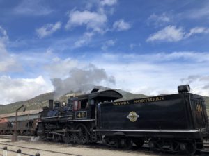
Courtesy S. Ward – Northern Nevada Railroad, The Ghost Train