Hottest, Driest, and Lowest National Park
In this below-sea-level basin, steady drought and record summer heat make Death Valley a land of extremes. Yet, each extreme has a striking contrast. Towering peaks are frosted with winter snow. Rare rainstorms bring vast fields of wildflowers. Lush oases harbor tiny fish and refuge for wildlife and humans. Despite its morbid name, a great diversity of life survives in Death Valley.
Flooding at Scotty’s Castle
The October flood in Grapevine Canyon was much larger than any flood event since the construction of Scotty’s Castle in the 1920s. The maximum flow was estimated at 3,200 cubic feet per second and deposited debris over 10 feet high.
Death Valley is the largest U.S. National Park outside Alaska at 3.4 million acres. Nearly 1000 miles of paved and dirt roads provide access to locations both popular and remote. Even so, 91% of the park is protected as officially designated Wilderness. That wild country includes low valley floors crusted with barren salt flats, rugged mountains rising as much as 11,000 feet, deep and winding canyons, rolling sand dunes, and spring-fed oases. Whether you have an afternoon or a week, careful planning will help make your visit safe and enjoyable.
Death Valley Virtual Museum: showcases Death Valley National Park and its collections that tell the stories of people drawn to this land of startling and stark beauty, scorching valleys and snow-capped peaks, borax mines, and a grandly furnished Castle.
Lodging information is provided on attached listings.
Numerous Camp Grounds are available – but it is recommended to check in advance as some season use restrictions or may otherwise not be available for use. RV hook ups are available but limited! Call ahead for space and availability.
Pictures below are provided by contributors or supporters of this website. If you are interested in sharing your pictures of Nevada, please drop us a note.

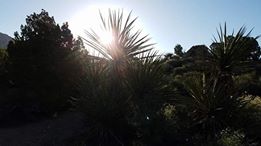
Courtesy T. Turner – Cactus Sunrise